|
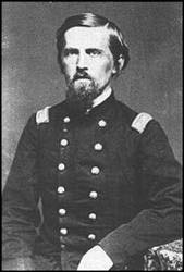
Following are selected places most of us know. If any reader wants to know about a place not listed, please email me and I will check my sources and get back to you by email. Adobe Summit: (On the road from Elko to Mountain City and Tuscarora) A small ranch and road station were maintained on the summit for freight wagons and stagecoaches. Its name was derived from the adobe mud that packed the wheels of the vehicles. Some present day maps call it "Doby" which is incorrect. Angel Lake: (East Humboldt Range southwest of Wells) A beautiful recreational lake which can be reached by automobile. Warren M. Angel came to Elko County is 1878. He had a ranch in Clover Valley. Carlin: Construction crews of the Central Pacific Railroad settled Elko County's oldest community in 1868. It was named for Captain William Passmore Carlin, a Civil War volunteer who was once stationed there. 
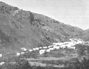
Charleston: Named for Tom Charles. The area was originally called Mardis after George Washington "Old Allegheny" Mardis. There was placer mining at a site four miles north of 76 Creek and the place became a lively camp with three schools, several stores, a hotel, ice house, saloon and other buildings. China Ranch: (In Elko) In the area of the city park and where the Northeastern Nevada Museum are located, local Chinese used the place as a garden for raising vegetables they sold in town. Their farm was irrigated by a ditch they dug from the Humboldt River near Osino to the gardens in Elko. They also supplied water to Elko from the ditch for a time. Clover Valley: An abundance of clover grew in the valley. It was called the Valley of Fifty Springs by the ill-fated Donner Party when they passed through. Contact: (Northern Elko County) Also known as the Salmon and Kit Carson mining districts, the area was discovered in 1870 and first worked on a commission basis by Chinese miners. Contact is mining term meaning the meeting of granite and porphyry. Currie: A town on the Nevada Northern Railroad between Cobre and McGill. Joseph H. Currie had a ranch on Nelson Creek in 1885. Deeth: (Between Elko and Wells) Settled in 1868 and named after a man called Deeth who ran a small store on the banks of the Humboldt River some two miles below the present town. Diamond A Desert: (Northern Elko County near the Idaho line) The brand of the Dan Murphy cattle outfit running cattle from Gold Creek to the desert was the "Diamond A." Dinner Station: (Twenty miles north of Elko) On the freight road from Elko to Tuscarora and Mountain City. It was first known as Weilands Station, named for the man who built the place. It here that stage passengers, teamsters, horses and mules rested and were fed. The name Dinner Station is obvious. Duck Valley: (At Owyhee) Indian reservation in northern Elko County established by Congress in 1877. Named for the ducks found in the area before the reservation was established. Elko: (County seat of Elko County) Elko County was formed from part of Lander County in March, 1869 and named for its principal community. There are three versions of the naming of the town: (1) The most believable is that Charles Crocker of the Central Pacific Railroad, who had a passion for naming stations after animals, simply added an O to Elk. (2) A small white girl was stolen by Indians from a party of emigrants. The Indians called her Elko which some say is an Indian word for White Elk. The child died near the Hot Springs off Bullion Road and the Indians referred to the area as Elko. (3) When surveyors were laying out the town site a party of Indians watched the proceedings with considerable interest and, when the stakes were being driven, one of them asked what the surveyors were making. One told them that there would soon be a town here like San Francisco and New York. The Indian exclaimed, "Elko!," said to be, in early accounts, an Indian word of disgust. The boss of the survey party said that was as good a name as any and wrote the name on board and nailed it to a post. Editor: Since these accounts were published I have been told there is no such term as Elko in the Shoshone language. So, we are back to the first account of naming the town...simply an O added to Elk which is not nearly as romantic or exciting as numbers two and three. Fort Halleck: Originally called Camp Halleck the post was established by Captain Samuel P. Smith in 1867. General H.W. Halleck was the Chief of Staff of the U.S. Army at the time. On the western slope of the Rubies it existed until 1886. The fort was established to protect emigrant groups and the railroad. Fort Ruby: (Ruby Valley in northern White Pine County) Established in 1862 by Colonel Edward P. Connor with 600 men who marched all the way from Stockton, California. A reservation of six square miles was laid out and given the name Camp Ruby. Its name came from the nearby mountains where pioneers found "rubies" and "ruby sand," actually garnets, in the gravel of the streams. Grindstone Mountain: (West of Dixie Creek and the South Fork of the Humboldt River) Called Moleen Peak on contemporary maps, one side of the mountain resembles grindstones. Its elevation is 7,377 feet. Harrison Pass: (Ruby Mountains) Thomas Harrison, a native of England, came to Elko County in 1865 and established a ranch in Ruby Valley. Humboldt River and all the other Humboldt names: Originally called the Barren River, then Paul's River in honor of one of Pete Skene Ogden's men who sickened and died on its banks. For a while it was called Ogden's River then was designated Mary's River, perhaps after the Indian wife of Ogden. Explorer Charles Fremont, in 1845, ignored the existing name and called it the Humboldt. Friedrich Henry Alexander, Baron von Humboldt, was a famous naturalist and explorer in the 19th centry. Jarbidge: The word Jarbidge comes from an Indian word, "Tsaw-haw-bitts,"
a name for a human-eating giant Indian thought to roam the canyon. Miners
twisted the spelling to Jahabich and then to Jarbidge. Often referred to
as Jarbridge which is incorrect.
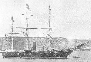
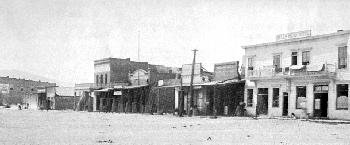
 Jiggs: Its name comes from the popular comic strip of the time, "Maggie and Jiggs." The town was called Skelton from 1884-1922, from Cynthia Skelton, the mother of Valley Paddock who raised horses in the vicinity. The place was then named "Hylton" who was a prominent figure in the town, finally, to Jiggs. Kittridge Canyon: C.B. Kittridge settled in Elko in 1871. Water from the canyon was used in Elko for many years. Lamoille:(Town, Valley, Canyon, Lake, and Creek) Thomas A. Waterman, one of the original settlers in Lamoille Valley, was a native of Lamoille County, Vermont. Lamoille is another twisted name. Originally it was "la Moutte," French for a gull. It might have been a map engraver's mistake of not crossing the t's. Lee: Named in honor of General Robert E. Lee by J.L. Martin who came to South Fork Valley in 1869. Maggie Creek: (Near Carlin) On early maps the stream was called Robin's Creek or Martin's Fork. A Scotch family, on their overland trek to California in 1849, camped near the stream and named it Maggie after one their little girls. Metropolis: (Twelve miles northwest of Wells) A land promotion scheme of the Pacific Reclamation Company. Using a name denoting a large city and prosperity, the company started the place in 1911. Drought, water rights litigation, high interest rates, jackrabbits and Mormon crickets contributed to the demise of the town and surrounding farms. Midas: First called Rosebud, then Gold Circle, because mines encircled the town. Its name was changed to Midas because Postal officials felt there were too many towns beginning with "gold" and would not establish a post office there unless the name was changed to Midas, a mythical king. Everything he touched turned to gold. Montello: An Indian word meaning "rest." The place was a small station on the Central Pacific Railroad. The watering place called Montello is actually eight or so miles from town. Oasis: (Between Wells and Wendover) Named after the Oasis Ranch of E.C. Hardy, a horse raiser in the Toana area in the late 1880s. Owyhee: Peter Skene Ogden of the Hudson's Bay Company first called the river the Sandwich Island River when two Hawaiians in his group were killed there by Indians. Captain James Cook visited Hawaii in 1776 and name the largest island in the group "Owyhee." American missionaries in the islands later reduced the native language to a written form and changed the spelling to "Hawaii." Pilot Peak: (Eastern Elko County) Name by John C. Fremont in 1845 because it served as a guide for emigrants in their western migration. Pleasant Valley: Named by the Seitz brothers, Edward and George, as a descriptive name for the valley nestled at the foot of the Ruby Mountains. Spanish Ranch: (Independence Valley, Tuscarora area) This cattle kingdom was put together by Bernardo and Pedro Altube, Spanish Basques who came to Elko County from California in 1870. Pedro, who stood six-feet, six inches in his stocking feet was known as Palo Alto, or "tall pine," and it is said that the California town takes its name from him. Pedro was elected to the Cowboy Hall of Fame as Nevada's candidate in 1960. Spring Creek: From the springs on a ranch known as the McKnight Ranch. Starr Valley: (Between Halleck and Wells) Lieutenant Augustus Washington Starr came with Captain S.P. Smith to established Fort Halleck in 1867. After leaving the army Starr bought land in the valley and is credited with being the place's first settler. By 1870 he had left the area. Te-Moak Indian Reservation: (Lee) Formed in the late 1930's by the government from established private cattle operations on the South Fork near Lee. The Bureau of Indian Affairs purchased several ranches and located Native American families of the Shoshone tribe of Te-Moak Indians on them. Named for Chief Te-Moak of Ruby Valley. The name means "rope." He was named that because he braided rope. Te-Moak rose to power among his people through personal influence, not hereditary lineage. He is remembered for the treaty he negotiated with the government to allow emigrants to pass through this region unmolested by the Indians. Thomas Canyon: (Branch of Lamoille Canyon, Ruby Mountains) Raymond Thomas, an Elko County High School teacher, took a trip into Lamoille Canyon on a beautiful day with ten other persons on October 1, 1916. In his effort to help other members of the party caught in a surprise snowstorm, the high altitude and severe storm conditions resulted in the death of Thomas. Tobar: (Southeast of Wells) A town on the Western Pacific tracks. A story is told that a saloon keeper in 1909, painted a sign reading "To Bar" and pointed it in the direction of his establishment. Railroad officials looking for a name for their new town, saw the sign and promptly named the place Tobar. Tuscarora: Two stories; (1) Steve and John Beard named the place
after the Indians living in their home state of North Carolina and (2)
When the mining district was formed one of the miners had served on the
U.S. Gunboat Tuscarora. The name of the boat also came from the southeastern
seaboard Indians.

Twin Bridges: (Lower South Fork, Humboldt River) Two bridges are in the area, one spans Smith Creek, the other the South Fork. Wells: Originally a rest stop for wagon trains, the community
was settled in 1869 with the name Humboldt Wells after the river and springs
that marked the beginning of the Humboldt Trail. Elko County Commissioners,
on May 6, 1873, shortened the name to Wells. The town was incorporated
in 1927.
 Wild Horse Reservoir: A dam was built in 1938 to store waters on the Owyhee River, which was replaced with a new structure in 1971. Wild horses were found in the area at one time. Wilkins: (Between Wells and Contact) Sometimes was called Thousand Springs Trading Post. Russell Wilkins was once the owner of nearby Winecup Ranch. Edited by Howard Hickson
September 14, 1998
I give my sincere thanks to my longtime friend, Edna Patterson, who is, without a doubt, the premier historian of northeast Nevada. In 1964 she compiled a small book of local place names published by the Elko Independent. In 1977 the Northeastern Nevada Historical Society published parts of the original book in its Quarterly. ©1998 by Howard Hickson. If any portion or all of this article is used or quoted proper credit must be given to the authors.
|