|
HOWARD
HICKSON'S HISTORIES
[Index]
Border Highjinks
They
Almost Left Elko, Wells and Las Vegas Out
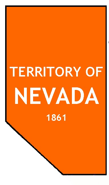
 When the Territory of Nevada was created in 1861 it was made up of 63,210
square miles of portions of Box Elder, Toelle, Millard, Beaver, Iron, and
Washington counties, Territory of Utah. The east boundary line was about
a mile east of the tunnel in Carlin Canyon. The area where Elko would grow
from the sagebrush was not included. So, what happened?
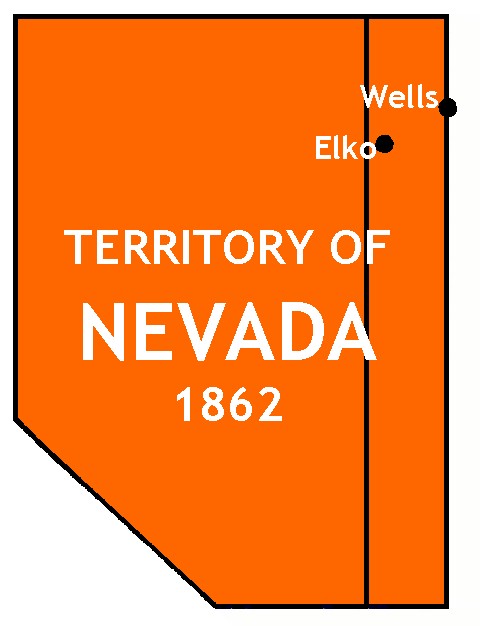
 In 1862 the territory was expanded east by one degree. By then, awmakers
back in Washington, D.C. were probably thinking about future funding for
the Civil War. That one degree added 18,325 square miles. Again, the land
gift was taken from Utah Territory. Elko's future site ended up in Nevada
this time but poor old Wells did not.
 Two years later, there was an unusual bout of Congressional finagling.
Now the highjinks really begin. Nevada didn't have enough people power
to become a state. No problem, the Washington people said and the rules
of population were bent a bit. Well, they were bent out of shape but that
didn't deter the politicians who wanted to marry us for our money. Yep,
they wanted to tie the old matrimonial knot so they could get their grubby
hands on our dowry - all that silver being dug from the hills at Virginia
City. Nevada became the 36th star on the American flag on October 31, 1864.
Right away we were dubbed with two nicknames: the Silver State, for obvious
reasons, and the Battle Born State, also for obvious reasons.
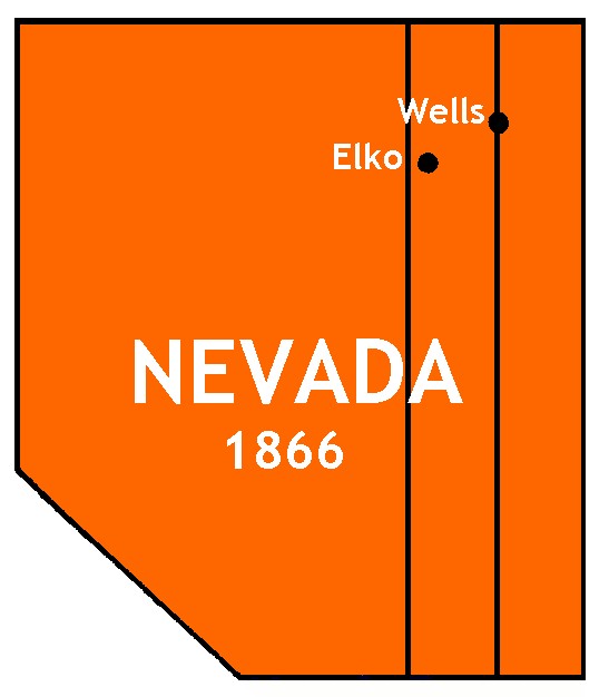
Another degree was taken from poor old Utah
Territory as a reward to the newest state in the Union. The land where
Wells would rise from the sagebrush became part of the Silver State in
1866. Nevada gained another 18,325 square miles.
We did a great job giving the Washington lawmakers
help to provide a lot of dollars to get them out of a budgetary crisis
caused by the Civil War. The government wasn't out anything anyway, they
were upset with the people of Utah Territory because of their marriage
habits. The whole transaction was rewarding one state while punishing a
territory. Washington was so ticked off that they didn't allow Utah to
become a state until 1896.
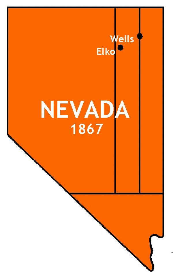
 Meanwhile, back in the District of Columbia, someone had another bright
idea. In 1867, a slab of Mohave and Pah-Ute counties, Arizona Territory,
was gifted to the Silver State. I guess they hankered for us to have a
point on our south end. The new piece of land added all of future Clark,
and parts of Esmeralda, Nye and Lincoln counties making us one big state.
Until Alaska became a state, Nevada was sixth in size. We are now, of course,
seventh - 110,567 square miles in total area.
I don't know why Washington punished Arizona
by taking away some of its land, but I do know that the newest chunk of
land now has a lot more than one-half the state's population living there.
If you are totally confused, that's okay.
What this whole dissertation adds up to is that the Territory expanded
once and the state grew twice to finally make up its present size and shape.
To add to the confusion, the government still owns more than eighty percent
of Nevada. So, what is all this benevolent horse manure about giving us
the land?
Howard Hickson
March 12, 2001
Source: Political History of Nevada, 1996, issued
by Dean Heller, Secretary of the State of Nevada. Illustrations by the
author.
©Copyright 2001 by Howard Hickson. Anyone is welcome
to quote or use any portion or all of this article but proper credit must
be given to the author.
[Back to Hickson's Histories Index]
|
 When the Territory of Nevada was created in 1861 it was made up of 63,210
square miles of portions of Box Elder, Toelle, Millard, Beaver, Iron, and
Washington counties, Territory of Utah. The east boundary line was about
a mile east of the tunnel in Carlin Canyon. The area where Elko would grow
from the sagebrush was not included. So, what happened?
 In 1862 the territory was expanded east by one degree. By then, awmakers
back in Washington, D.C. were probably thinking about future funding for
the Civil War. That one degree added 18,325 square miles. Again, the land
gift was taken from Utah Territory. Elko's future site ended up in Nevada
this time but poor old Wells did not.
 Two years later, there was an unusual bout of Congressional finagling.
Now the highjinks really begin. Nevada didn't have enough people power
to become a state. No problem, the Washington people said and the rules
of population were bent a bit. Well, they were bent out of shape but that
didn't deter the politicians who wanted to marry us for our money. Yep,
they wanted to tie the old matrimonial knot so they could get their grubby
hands on our dowry - all that silver being dug from the hills at Virginia
City. Nevada became the 36th star on the American flag on October 31, 1864.
Right away we were dubbed with two nicknames: the Silver State, for obvious
reasons, and the Battle Born State, also for obvious reasons.
 Meanwhile, back in the District of Columbia, someone had another bright
idea. In 1867, a slab of Mohave and Pah-Ute counties, Arizona Territory,
was gifted to the Silver State. I guess they hankered for us to have a
point on our south end. The new piece of land added all of future Clark,
and parts of Esmeralda, Nye and Lincoln counties making us one big state.
Until Alaska became a state, Nevada was sixth in size. We are now, of course,
seventh - 110,567 square miles in total area.